- 2perception outputsDrivable space and lane boundaries from one segmentation
- RANSACground-plane fitRobust to outliers and clutter at the road edge
The challenge
A segmentation network labels every pixel, but a planner needs geometry: a drivable surface it can trust and lane boundaries it can follow. Segmentation errors and clutter at the road edge make naive geometry brittle.
Our approach
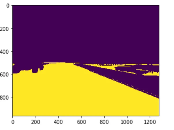
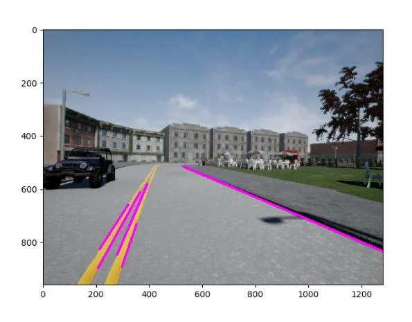
Road pixels from the segmentation output seed a ground-plane estimate fitted with RANSAC, which rejects outliers and yields the drivable space. Lane-marking pixels from the same output are fitted to lane boundaries and projected back onto the camera frame.
Workflow
How it works, step by step.
The pipeline in 4 stages, from perceive to hand off. Each stage has a clear input, a clear output and a reason to exist.
- 01
Perceive
Camera frames pass through a semantic segmentation network.
- 02
Fit ground
Road pixels are fitted to a ground plane with RANSAC to estimate drivable space.
- 03
Find lanes
Lane-marking pixels from the segmentation are fitted to lane boundaries.
- 04
Hand off
Drivable area and lanes are overlaid on the frame as input for planning.
Results
What it produced.
Stack & techniques
- Semantic segmentation
- RANSAC plane fitting
- Lane estimation
- Python
Delivered by members of the Saerosense founding team. Client names are withheld unless public — references are available on request.
Related service
Start a project
Have a similar problem?
Send a few lines about your data and the outcome you want. We reply within two business days with a feasibility read and a proposed scoping plan.